
All layout maps of Rohini
Direct download or view High Resolution layout Maps of Rohini. Available Maps- Rohini sector 34 & 35, Sector 36|37|38, Rohini(All sectors map included), new allotment, unauthorised colonies of Rohini, futuristic layout plan of Rohini, Rohini and Zone N, UER-1|2|3 image and google map, Rithala-Bawana-Narela Proposed image and Google map, Zone N delineation of sectors & roads.
Rohini Sector 34 & 35 High Resolution Layout Map
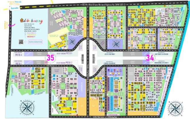
High Resolution Image : Download
Description: This is a very high resolution layout plan map of Rohini Sector 35 & 36. Viewing and downloading may take some time but this is the finest one for better understanding.
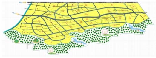
Rohini Sector 36, 37 & 38's High Resolution Layout Map
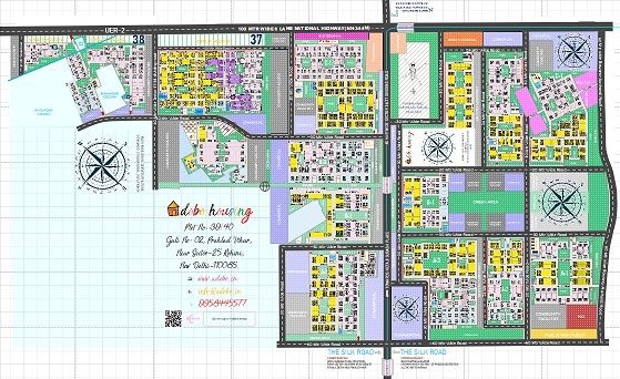
High Resolution Image : Download
Description: This is a very high resolution layout plan map of Rohini Sector 36, 37 & 38. Viewing and downloading may take some time but this is the finest one for better understanding.
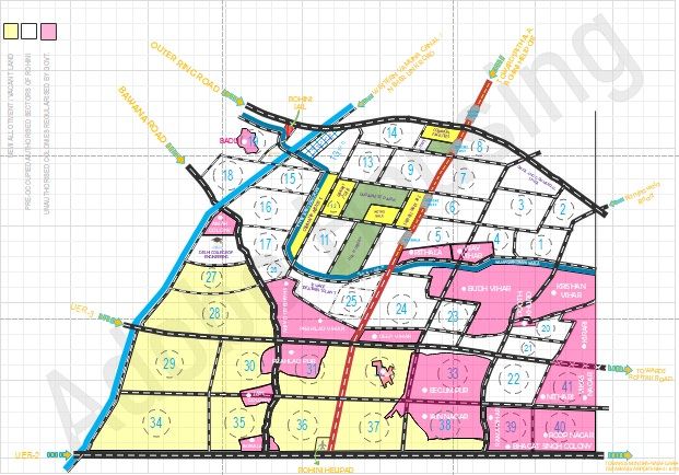
Proposed Rohini Layout Map
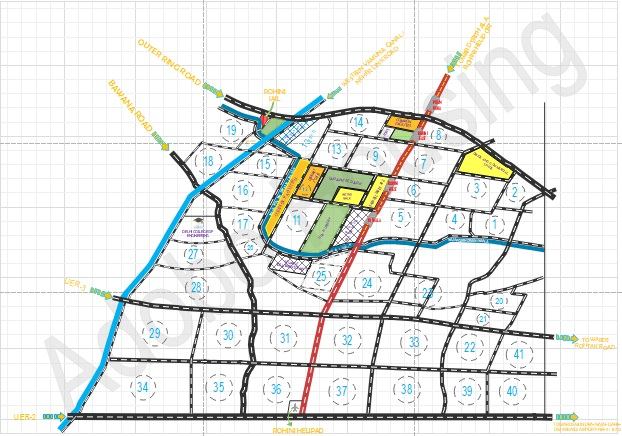
High Resolution Image : Download
Description: This image shows us all the proposed(in 1981 or later planning) sectors of Rohini including existing, new allotment & proposed and upcoming sectors of Rohini.
Unauthorised colonies of Rohini Layout Plan Map
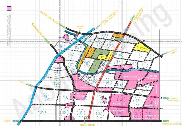
High Resolution Image : Download
Description: This layout shows us all the unauthorised colonies(Pink) with all the sector boundaries touching these colonies.
Existing | New Allotment | Unauthorised Sectors of Rohini
High Resolution Image : Download
Description: This Layout shows us all the three categories in which Rohini is divided. All rohini with Existing, new allotment & unauthorised sectors can seen in this image.
Futuristic Layout Plan Map of Rohini
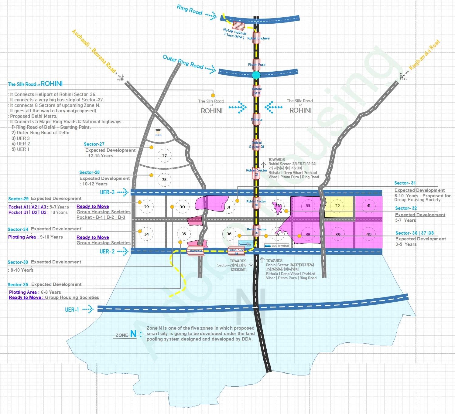
High Resolution Image : Download
Description: Sector wise futuristic and expected development of Rohini with expected occupancy, The silk road of Rohini route, proposed metro, UER-1|2|3, DDA's upcoming proposed Zone N.
Futuristic Rohini | Zone N | Silk Road | Metro Layout Map
High Resolution Image : Download
Description: Get a detailed futuristic idea when Zone N will come and will be attached with Rohini. We have shown both layout to give you the idea of future. The silk Road of Rohini will play a very vital role in future.
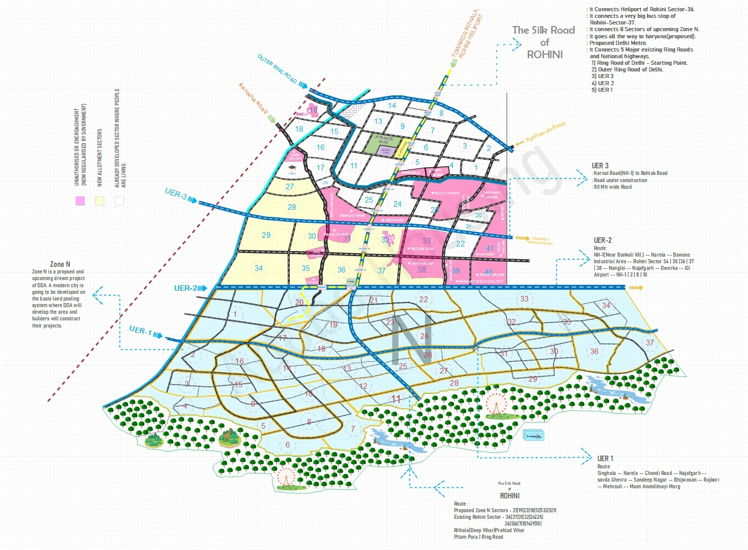
Upcoming DDA's Zone N Sector Delineation
High Resolution Image : Download
Description: This layout shows futuristic Zone N's sector wise delineation plan.
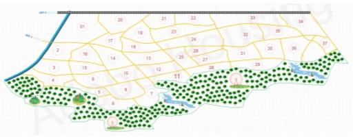
Zone N's Sector & Road Delineation
High Resolution Image : Download
Description: This layout shows Zone N's sector delineation plan with roads.
Proposed & Existing Delhi Metro Route Map
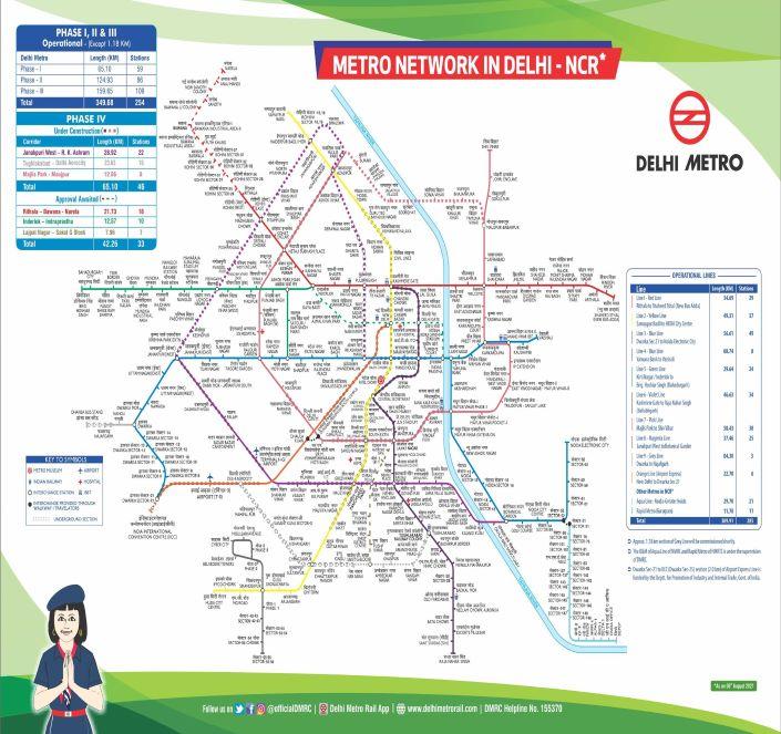
High Resolution Image : Download
Description: This a layout plan map of Delhi Metro routes including all proposed metro lines of Delhi. It also shows Rithala-Bawana-Narela Metro proposed plan.
Source: www.delhimetrorail.com
Proposed Rithala-Bawana-Narela Delhi Metro Google Map
Description: Proposed Rithala-Bawana-Narela Metro line plan on Google maps with metro stations.
Urban Extention 1|2|3 Layout map
-1-2-3-Layout-Map-s.jpg)
High Resolution Image : Download
Description: This map shows different zones of Delhi including Zone M(Rohini) and Proposed Zone N with three proposed Urban extensions roads on map.
Proposed Urban Extension Road(UER)-1/2/3 Google Maps Route
Description: This shows Urban Extention Road(UER)-1, 2 & 3 on google maps for better understanding.